GPS data storage, editing, and enrichment - simplified.

Take your data beyond latitude and longitude with Mapkind GPS.

Start mapping

Features

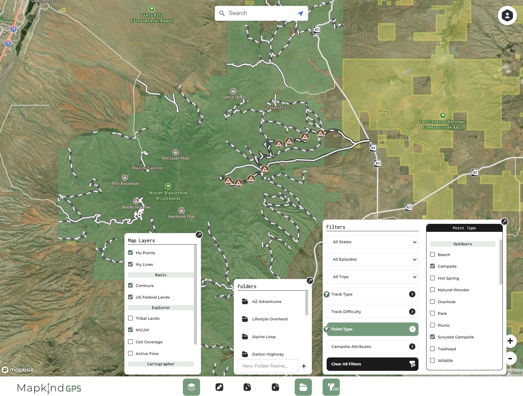
Mapkind GPS provides the tools and reference data you need to take your data beyond latitude and longitude.

Learn more
  • Upload your existing GPS data.

  • Edit, create, and enrich features with Mapkind attributes to drive our powerful filtering functionality.

  • Filter your data to display the exact features you need for your next adventure.

  • Stay organized by using our simple and intuitive folder system.

  • Turn map layers on and off, switch basemaps, and add data from our layer list. Upgrade your plan to unlock premium map layers.

Planner

Starting at
$0/yr
Get started for free! No expiration date... Free forever!
Start MAPPING
  • Basic map layers
    Upload existing GPS data (GPX or GEOJSON)
  • Map feature photo attachments
  • All feature attributes
  • Map feature filtering
  • Unlimited folders
50MB Data Storage Add-on
$5/yr
ADD STORAGE
  • 50MB GPS data storage
*Available to Premium subscribers
10 Photo Attachments Add-on
$5/yr
ADD PHOTOS
  • 10 photo attachments per feature
*Available to Premium subscribers

Cartographer

Starting at
$24.99/yr
Unlock the full potential of Mapkind GPS!
Get started
  • Explorer features, plus:
  • 50mb GPS data storage
  • Cartographer map layers
  • 10 photo attachments per feature
  • Unlimited folders
*Additional storage may be added